Members

Raymond Kristiansen – Professor
- Modeling and nonlinear control of dynamical systems
- Parameterization of dynamical systems with (dual) quaternions
- Synchronization and coordinated control of agents in formations
- Unmanned aerial vehicles, with a special focus on multirotor systems
- Satellites and satellite formations
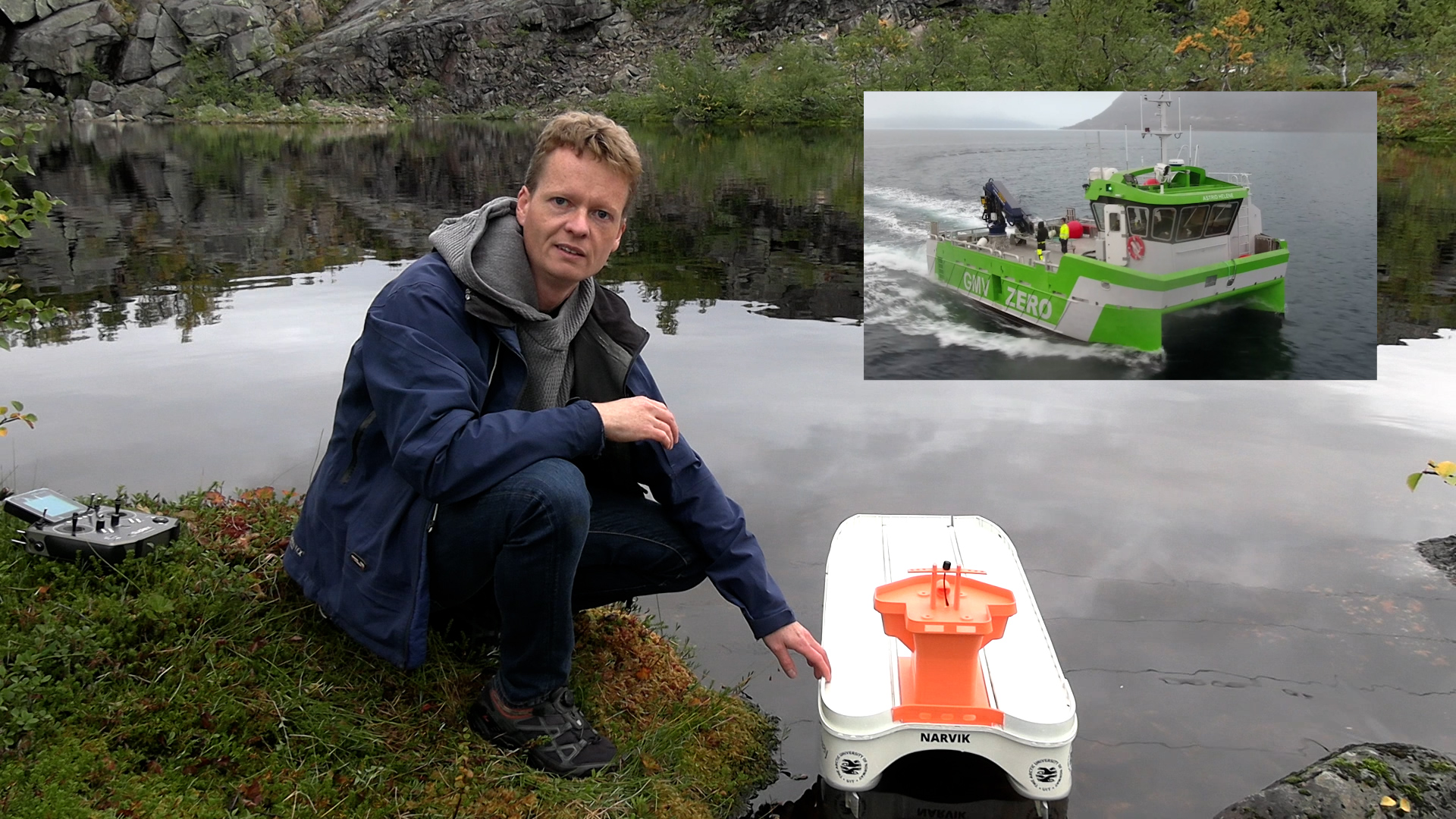
- Autonomous ships
- Robotics

Bjarte Hoff – Professor
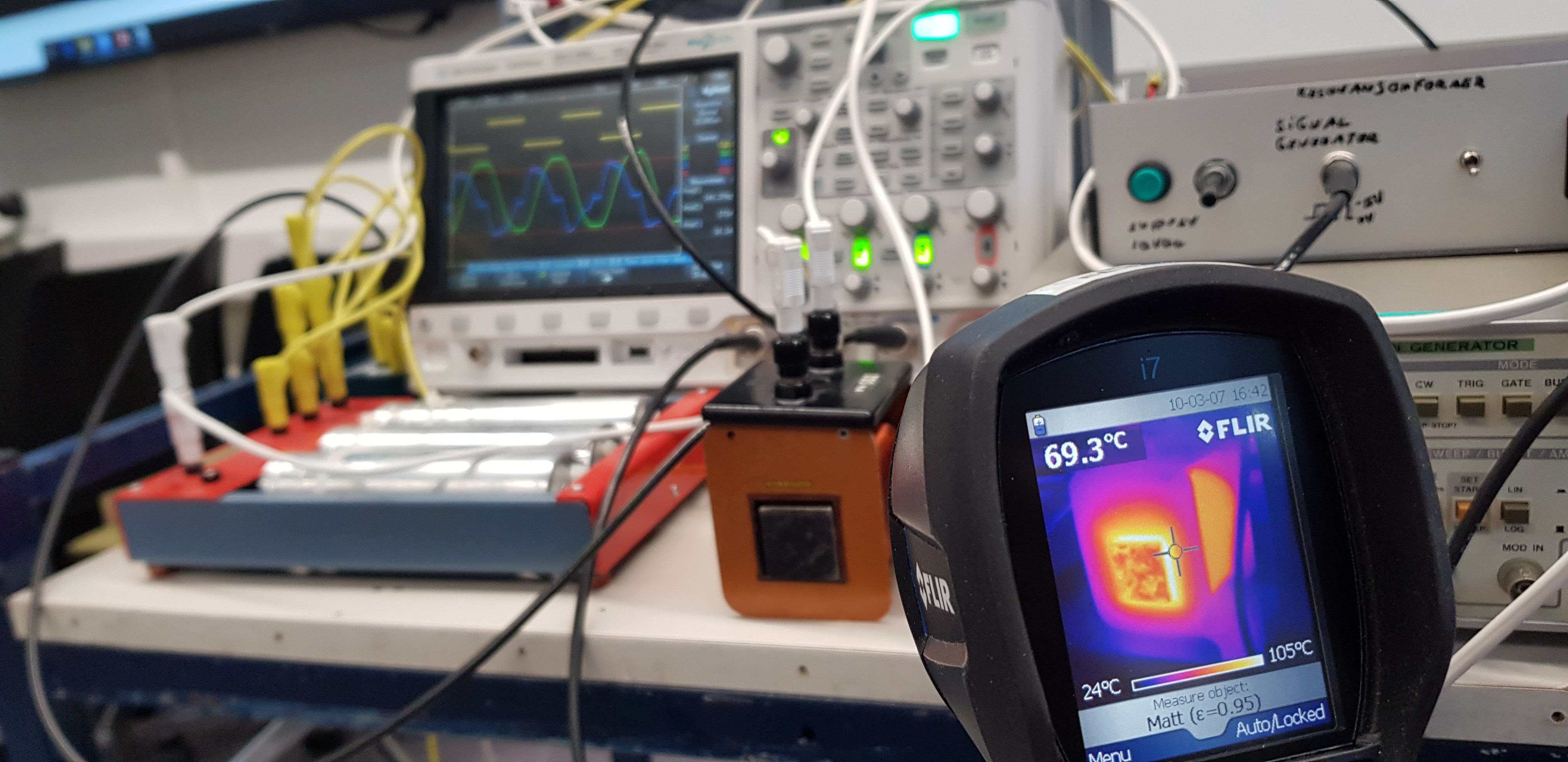
My research field is power electronics with application within future energy system and electric transport, two inspiring areas that are important for the transition to a sustainable future. The use of power conversion technology through power electronics and associated control algorithms is essential for renewable energy, electric transport and energy storage. Charging of electric vehicles, maritime vessels and aircrafts is combining all those research areas on both component and system level, representing an important element for the electric future.
Keywords:
- Power electronics and associated control algoritms, inc. predictive control
- Low voltage elektrical installations
- Microgrids, distributed generation, renewable energy and smart grids
- Electric transport

Trond Østrem – Associate Professor
- Distributed generation
- Power electronics
- Power system stability
- Electric transportation

Pawan Sharma – Associate Professor
Power System Dynamics and Control, Distributed Power Generation and its Integration to Grid, Optimization Methods, Micro-Grids, Electric Vehicles, and Smart Grids.

Pål Gunnar Ellingsen – Associate Professor
Research projects:
Space Debris Radar ( 2023 – 2025): Projeect leader for developing a space debris radar. Financed by ESA through PRODEX.
QBDebris (2023 – 2027): WP leader in the project with responsibility for the development of a space debris radar. Financed by the Norwegian reserach council through FRIPRO, contract #335832
SHIPTRACK (2021–2025): WP leader. The project aims at tracking ships and bulk cargo with AIS and remote sensing. Financed by the Norwegian reserach council contract number #326609
Vi tar Nord-Norge til stjernene – UiT Norges Arktiske Universitets studentsatellitt (2022 – 2026). Project leader.
Arven etter Nansen (2018–2023): Participant in RA-B og RA-C, with responisbilities within data management and ocean colour.
Reserach interests:
- Optical instrumentation
- Hyperspectral imaging (both remote sensing and in situ)
- Spectroscopy
- Image processing
- Aurora and ionospheric processes
- Ocean colour
- Shipping
- Optial communication
-
Data management

Jose Juan Corona Sanchez – Associate Professor
I have a background in mechatronics systems, focusing on unmanned aerial vehicles. I have considerable experience in mathematical modeling, navigation, guidance, and control of UAVs. During my career, I have worked developing physical prototypes.

Hussein Mahdi Yaseen Al-Sallami – Associate Professor

Theresa Rexer – Associate Professor

Knut Ola Dølven – Associate Professor
Arild Steen – Head of Department

Umer Sohail – Assistant Professor
My research interests include power electronics and their applications in next-generation energy systems and electrified transportation. I focus on the modeling, design, and optimization of power conversion technologies and control algorithms for renewable energy integration, battery energy storage systems, electric mobility, and power quality improvement. I also have an interest in the application of artificial intelligence and machine learning techniques for data-driven analysis and control of energy systems.
I have a particular interest in the design and analysis of charging infrastructure for electric vehicles, maritime vessels, and electric aircraft, addressing challenges at both the converter level and system-level interaction with the grid. My work also encompasses microgrids, distributed energy resources, and smart grids. These systems are studied in the context of remote communities and Arctic buildings, with an emphasis on system resilience, reliable operation, and power quality.
Additionally, I place significant emphasis on power supply security in cold-climate environments, ensuring reliable and uninterrupted power supply for critical applications. I also investigate energy systems for aquaculture and fish farming, focusing on efficient and robust energy utilization in these applications.
Keywords
Power electronics and advanced control algorithms
Microgrids, distributed energy resources, renewable energy, and smart grids
Electrified transportation and charging infrastructure
Energy systems for arctic buildings
Energy supply security
Backup power systems and system resilience
Energy systems for aquaculture and fish farms

Tom Stian Andersen – Assistant Professor

Tobias Thorvaldsen – Staff Engineer


Alessio Bocci – Doctoral Research Fellow

Laura-Kristin Scholtz – Doctoral Research Fellow
Isaac Kweku Aidoo – Doctoral Research Fellow
Ulrik Noer – Doctoral Research Fellow