Varanger peninsula
Varanger Peninsula is a climate-determined borderland between low-Arctic tundra, mountains, and sub-Arctic Forest.
This complex of ecosystems provides unique opportunities for research aimed at documenting the effects of the ongoing warming of the northern regions and finding out how Arctic species and ecosystems can be preserved.
The map on the right shows the vegetation productivity on the Varanger Peninsula; the darker the green area, the more productive it is. Hatched areas in black show areas with forest.

Large parts of the Varanger Peninsula lie north or east of the polar tree line and therefore belong to the Arctic climate zone.
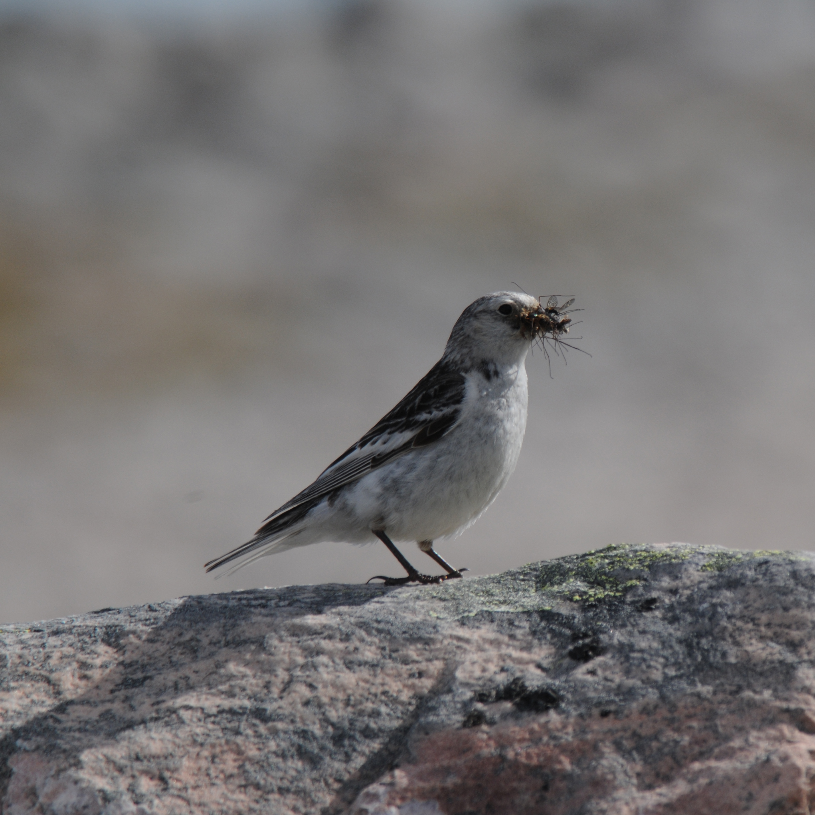
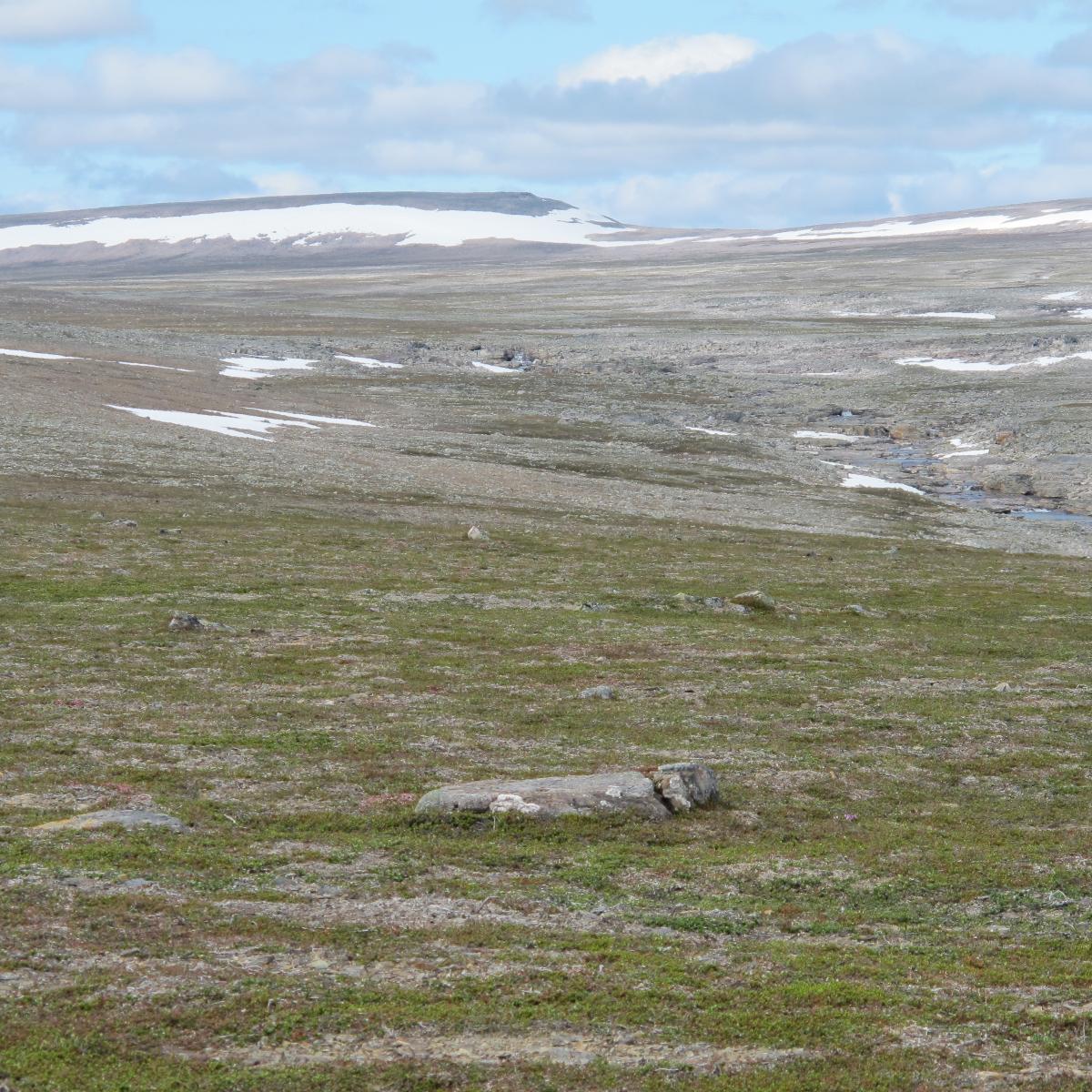
In the inner, higher-elevation parts of the peninsula, 400-600 meters above sea level, the growing season is so short, and the substrate so dominated by gravel and coarse stone (block fields) that the landscape resembles a polar desert. Permafrost is found here in patches.
In this inhospitable landscape, some Arctic plant species find their living conditions – as the only place on the Norwegian mainland. This is the home of the rock ptarmigan and the snow bunting. Also, red-listed species such as the Arctic fox and the snowy owl have their last strongholds in the cold interior of the Varanger Peninsula.
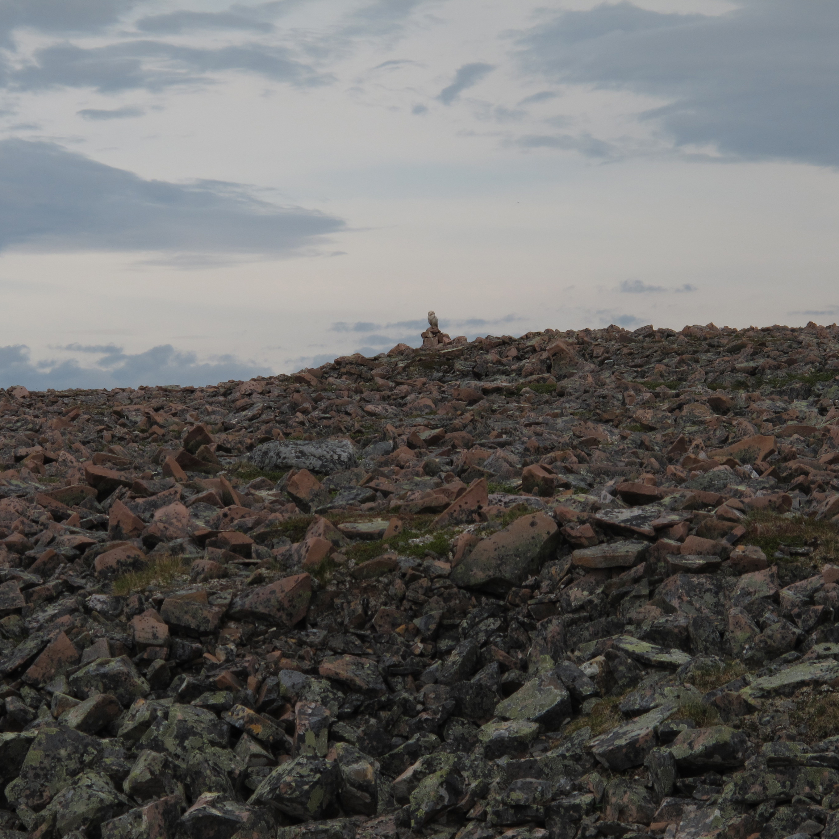
Snowy owl in block field on the Varanger Peninsula.
Photo: Rolf A. Ims
Snow bunting in block field on the Varanger Peninsula.
Photo: Geir Vie
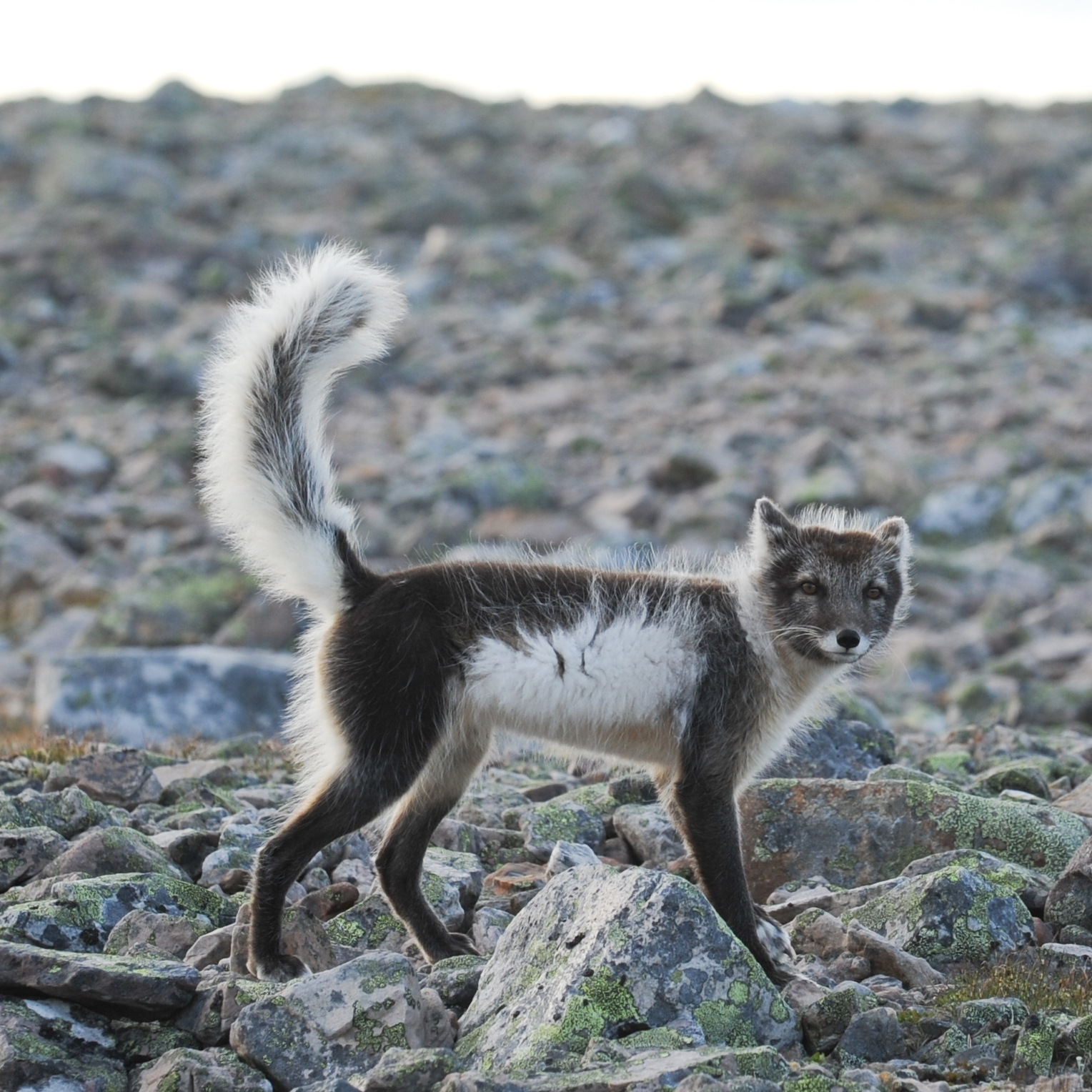
Arctic fox in block field on the Varanger Peninsula.
Photo: Geir Vie
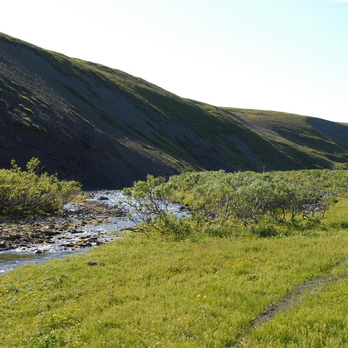
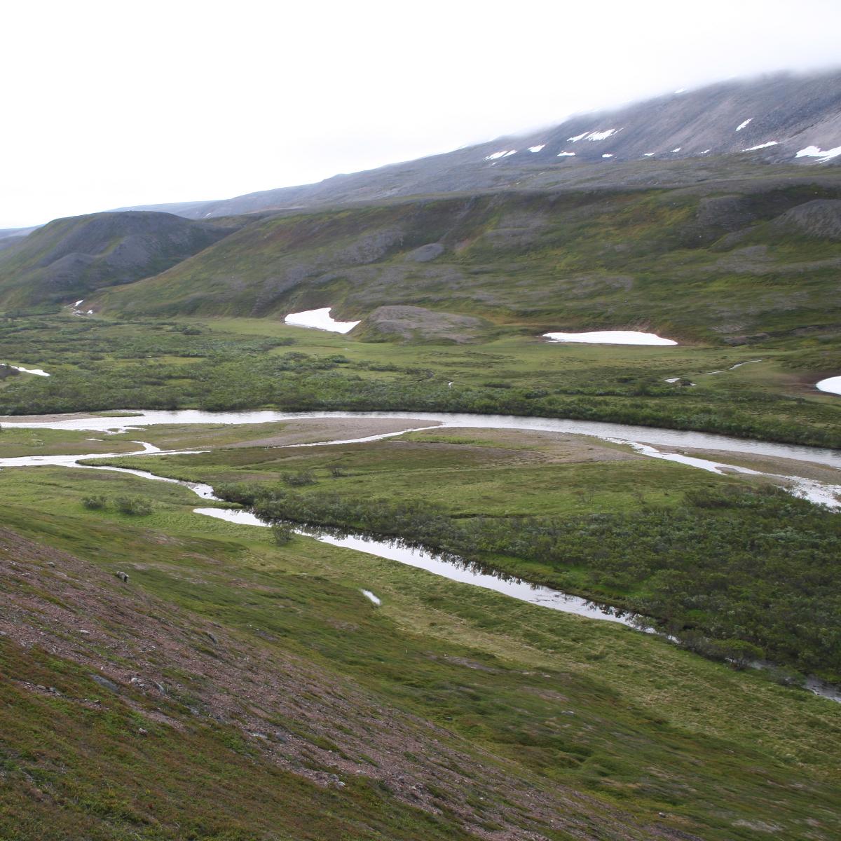
The inland plateau of the Varanger Peninsula is drained by a number of rivers that have productive populations of all our three anadromous salmonid fish species – trout, Arctic char, and salmon.
The vegetation in the river valleys is more productive than the more barren surrounding heaths.
Therefore, much of the biological diversity - including resource species such as cloudberries, reindeer, moose, hare, and willow ptarmigan - is concentrated in habitats such as bogs, meadows, and willow thickets along the watercourses on the Varanger Peninsula.
Read more about the diversity in the river valleys under shrub tundra.
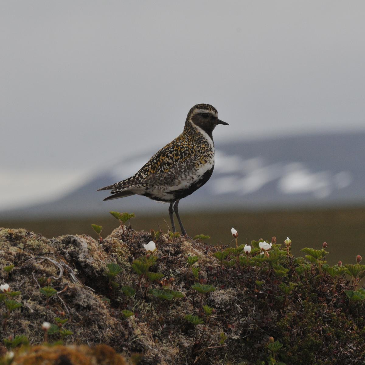
Eurasian golden plover in cloudberry bog.Photo: Geir Vie
Moose calf in sedge marsh.
Photo: Geir Vie

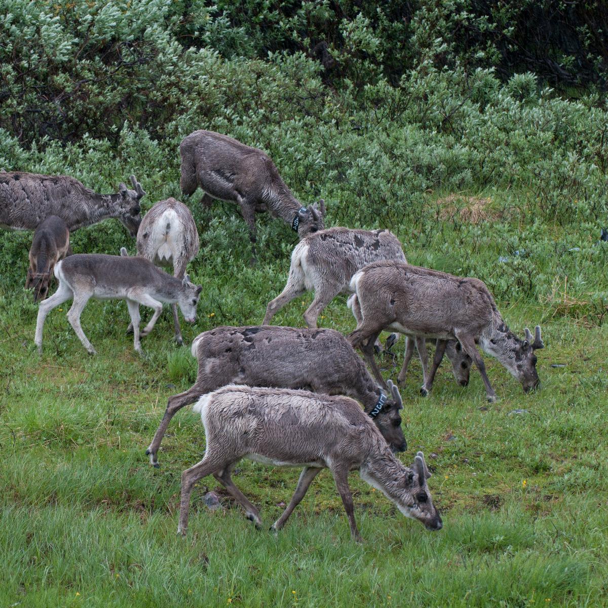
Reindeer in productive willow meadow.
Photo: Geir Vie
Lush meadow in river valley.
Photo: Geir Vie
Bergebydalen and Vestre Jakobselv
The catchment areas of the Bergeby River (Souvvejokha) and Vestre Jakobselv River (Annejokha) in the municipalities of Nesseby and Vadsø are an "intensive area" for COAT's monitoring activities in the western part of the Varanger Peninsula. This area provides good opportunities to monitor climate and ecosystems at different elevations.
We examine areas from low land birch forest through productive meadows with willow thickets along rivers and streams low in the terrain, to higher elevation areas (up to 400 meters above sea level) with sparse heath vegetation and snowbeds.
COAT has established 3 weather stations that cover this altitude gradient. The Skoarrojohka field station, which was built in 2019, serves as a base for COAT researchers operating in this area.
Read more about our weather stations
Read more about our field stations
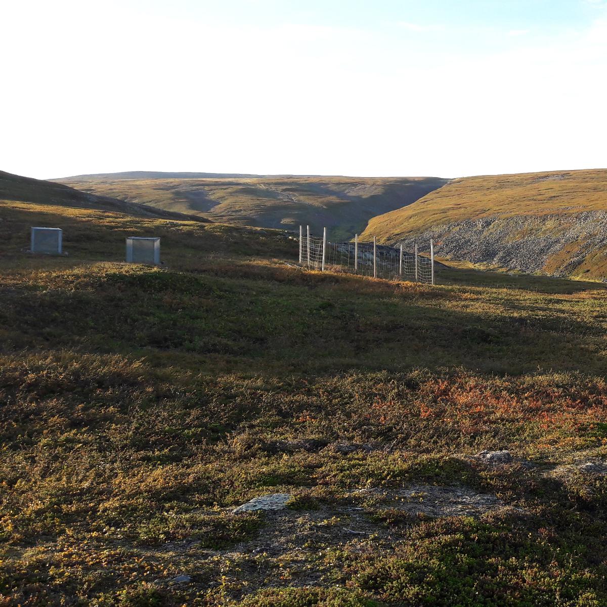
Above the tree line in Bergebydalen, we have set up fences (exclosures) that keep reindeer and other herbivores away from certain types of vegetation. This allows us to research how grazing animals affect the vegetation on the tundra.
Photo: Jan Erik Knutsen
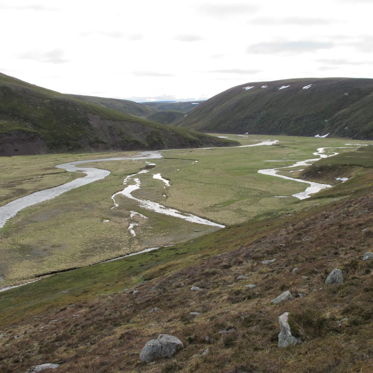
The tundra in the catchment area of the Bergeby River
alternates between nutrient-poor heath
and lush meadows with willow thickets.
Photo: Julia Mikhailova
Komagdalen and Sandfjordalen
Komagdalen and Sandfjordalen in the municipalities of Vadsø, Båtsfjord, and Vardø together constitute an "intensive area" for COAT's monitoring activities in the eastern part of the Varanger Peninsula. Most of the areas within both valleys are located within Varanger Peninsula National Park.
The monitoring takes place at different altitudes, from productive meadows, and willow thicket areas along the rivers at the bottom of the valleys, to barren heaths, block field areas, and snowbeds above 400 meters above sea level.
COAT has established 4 weather stations that cover the altitude gradient in these areas. As a base for their operations in Komagdalen and Sandfjordalen, COAT researchers use the Hubehytta. This is one of the old line cabins on the Varanger Peninsula that has just been renovated by COAT to function well as a field station.
Read more about COAT's infrastructure
In the higher parts of Komagdalen, you can
find barren heaths and bolder fields.
Photo: Rolf A. Ims
At the bottom of Komagdalen, there are lush meadows
with willow thickets.
Photo: Rolf A. Ims
Sandfjordalen has lush meadows but lacks willow thickets.
Photo: Rolf A. Ims